
There’s no better way to explore the vast and diverse landscape of the United States than by hitting the open road. With iconic highways, breathtaking natural wonders, and dynamic cities, the U.S. is a road tripper’s paradise. The secret to an unforgettable journey? A good plan—and a USA map as your best companion.
In this guide, we’ll walk you through how to use the USA map to plan your perfect cross-country road trip, including route ideas, tips, and must-see destinations.
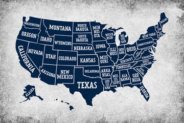
🗺️ Why the USA Map is Essential for Road Trip Planning
Even in the age of GPS and mobile apps, having a physical or detailed digital map of the USA offers unbeatable benefits:
-
Visual overview of route options and states
-
Offline reliability in remote areas
-
Helps track progress and identify attractions by region
-
Useful for spotting alternative scenic routes
Planning with a USA map gives you full control over your adventure.
🛣️ Popular Cross-Country Routes
Before you hit the road, decide on the kind of trip you want—coastal, historic, natural beauty, or city-hopping. Here are a few iconic cross-country routes to consider:
1. Route 66 – Chicago, IL to Santa Monica, CA
States: Illinois, Missouri, Kansas, Oklahoma, Texas, New Mexico, Arizona, California
Highlights:
-
Classic Americana: diners, motels, and neon signs
-
Petrified Forest National Park (AZ)
-
Cadillac Ranch (TX)
-
Santa Monica Pier (CA)
2. The Northern Route – Seattle, WA to Bar Harbor, ME
States: Washington, Idaho, Montana, North Dakota, Minnesota, Wisconsin, Michigan, New York, Vermont, New Hampshire, Maine
Highlights:
-
Glacier National Park
-
Great Lakes
-
Adirondacks and White Mountains
-
Acadia National Park
3. The Southern Route – San Diego, CA to Savannah, GA
States: California, Arizona, New Mexico, Texas, Louisiana, Mississippi, Alabama, Georgia
Highlights:
-
Sonoran Desert
-
Austin music scene
-
New Orleans culture
-
Coastal Georgia charm
4. The Pacific Coast Highway (PCH) – San Diego, CA to Seattle, WA
States: California, Oregon, Washington
Highlights:
-
Big Sur cliffs
-
Redwood forests
-
Crater Lake National Park
-
Olympic National Park
5. The Trans-America Trail (for Off-Roaders)
From: North Carolina to Oregon
Type: Mostly off-road and unpaved routes
Highlights: Ideal for adventure lovers with 4x4s or motorcycles
🧭 How to Plan with the USA Map
Here’s how to effectively use a map to craft your perfect journey:
Step 1: Choose Your Start and End Points
Decide if you’re:
-
Going one-way or round trip
-
Starting from home or flying to a city to begin the trip
-
Ending at a coast, national park, or iconic city
Use the map to draw potential start and finish lines.
Step 2: Plot Major Stops by Region
Divide the U.S. into regions:
-
Northeast: History and cities (Boston, NYC)
-
South: Music and food (Nashville, New Orleans)
-
Midwest: Lakes and plains (Chicago, Minneapolis)
-
West: Mountains and parks (Denver, Yellowstone)
-
Pacific: Coastlines and tech hubs (San Francisco, Seattle)
Mark these on the map to visualize your flow.
Step 3: Factor in Scenic Byways and National Parks
Use your map to identify and highlight:
-
Scenic Byways (e.g., Blue Ridge Parkway, Highway 1)
-
National Parks (e.g., Grand Canyon, Yosemite, Zion)
-
Cultural routes (e.g., Blues Highway, Civil Rights Trail)
These add depth and beauty to your road trip experience.
Step 4: Consider Distance & Time
Use the map’s scale to estimate mileage. Pro tips:
-
Average 300–500 miles/day for comfort
-
Allow buffer days for weather or rest
-
Plan shorter drives if traveling with kids or elderly
Step 5: Mark Overnight Stays and Amenities
Highlight cities or towns where you can:
-
Book hotels or motels
-
Camp or stay in RV parks
-
Find gas stations, restaurants, grocery stores
This helps prevent being stranded in remote areas.
🏕️ Must-See Road Trip Destinations
Here are must-visit landmarks by region to add to your USA map:
| Region | Destination |
|---|---|
| West | Yosemite, Grand Canyon, Las Vegas |
| Southwest | Sedona, White Sands, Big Bend |
| Midwest | Mount Rushmore, Badlands, Chicago |
| South | Great Smoky Mountains, Nashville |
| Northeast | Niagara Falls, Acadia, NYC |
| Pacific | San Francisco, Redwoods, Seattle |
Don’t forget to mark quirky roadside attractions like the World's Largest Ball of Twine or Meteor Crater in Arizona!
🚗 Road Trip Essentials
Aside from your USA map, make sure you bring:
-
Phone charger & mount
-
Offline GPS or road atlas
-
Cooler with snacks and drinks
-
First aid kit
-
Cash for tolls and small towns
-
Camping gear (if needed)
A well-stocked car is your mobile survival kit!
📱 Best Apps to Use Alongside Your Map
-
Roadtrippers: Great for planning stops
-
GasBuddy: Find cheapest gas
-
iOverlander: Camping and rest spots
-
AllTrails: Hiking near your route
-
Google Maps: For real-time directions (when connected)
However, nothing beats tracing your route on a full USA map, especially for spotting off-the-beaten-path opportunities.
🧠 Tips for an Epic Cross-Country Trip
-
Travel off-season to avoid crowds and save money
-
Be flexible—some of the best moments are unplanned
-
Talk to locals for hidden gems
-
Take breaks—don’t overdrive
-
Create a playlist or download audiobooks for the journey
-
Document your trip with photos and a journal
🗺️ Final Thoughts
Planning your road trip with a USA map is not just about navigation—it’s about crafting a story. Each city, highway, and park becomes a chapter in your adventure. Whether you're cruising Route 66, camping under the stars in Utah, or enjoying clam chowder in Boston, the map will always lead you to something magical.
So grab a marker, spread out your USAmap, and start plotting the road trip of a lifetime!